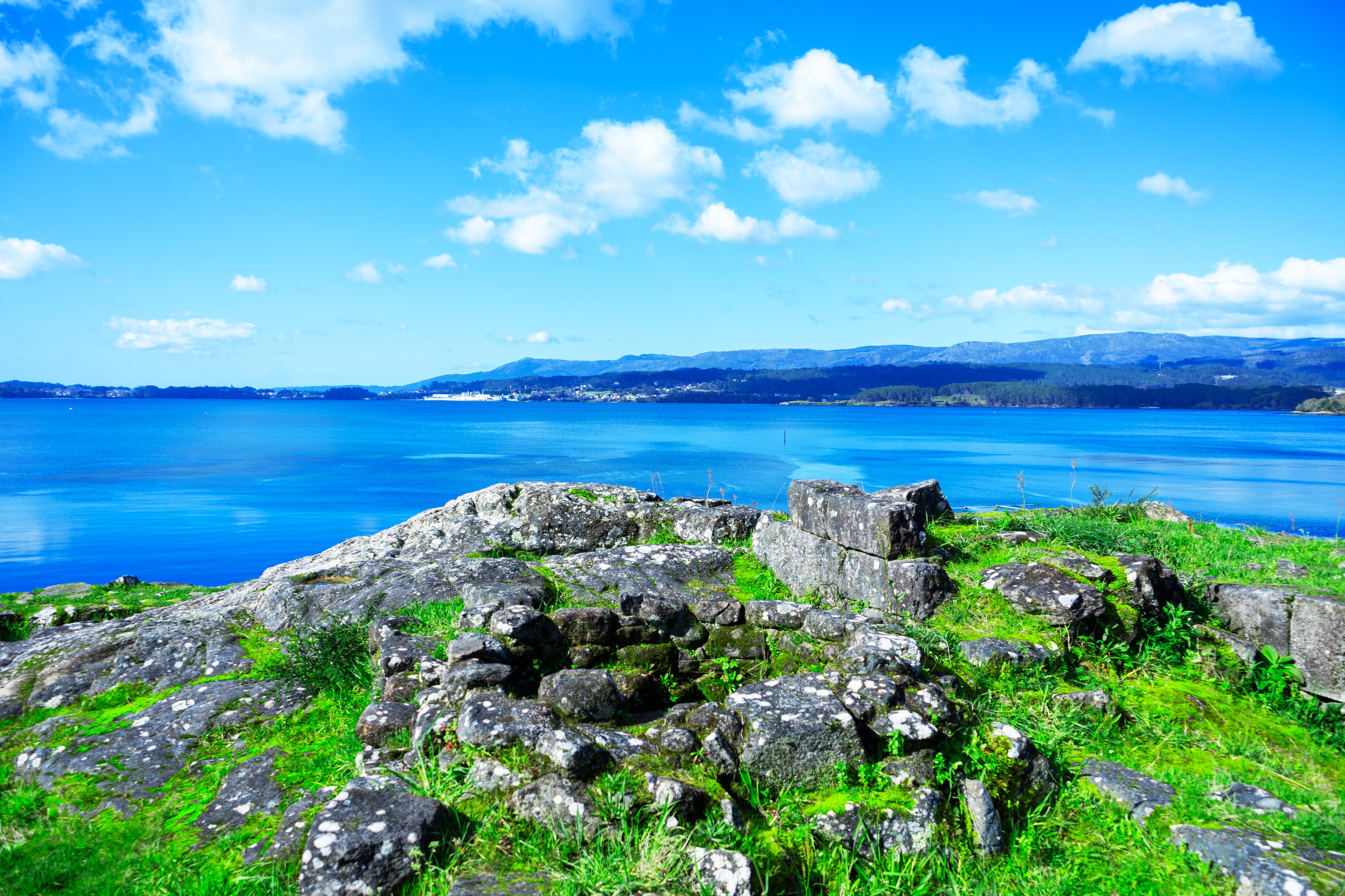
3-Day Itinerary
You have three days ahead to explore the captivating destination of Barbanza-Arousa. A rich and varied offer highlighting cultural and natural heritage that will make your stay an unforgettable experience.
Day 1: A Pobra do Caramiñal - Ribeira - Corrubedo
You will start your day in the municipality of A Pobra do Caramiñal. It is a coastal village that also boasts a magnificent mountain backdrop, which is where today's itinerary begins. Later, you will head to the neighboring town of Ribeira and end the day next to Corrubedo Lighthouse, embraced by the whistle of a raging sea.
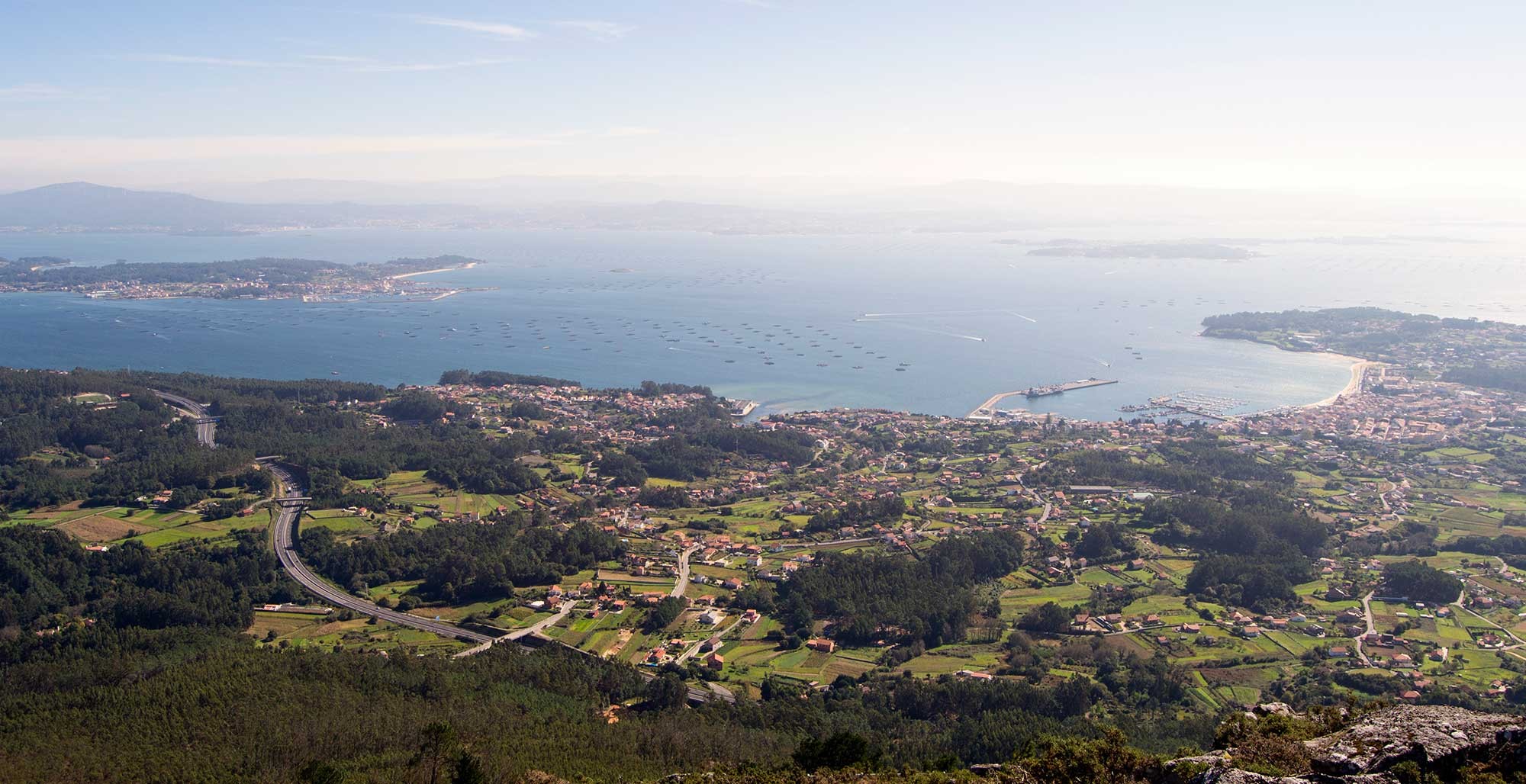
The A Curota Viewpoint will be the starting point of the route since, located over 500 meters high, it offers a complete overview of Barbanza-Arousa, making it the ideal spot for introducing the region. On the drive up, you will be greeted by the monument to Valle-Inclán, a renowned writer closely connected to A Pobra who enjoyed these views so many times.
Upon arrival, the four municipalities you will visit during these three days (Ribeira, A Pobra do Caramiñal, Boiro, and Rianxo) will unfold before you, united by the spectacular Serra do Barbanza mountain range (which gives its name to the region) and, of course, the magnificent Ría de Arousa bay. This sea inlet reaching into the coast makes these calmer waters exceptionally fertile for shellfish farming. So much so that you can see the vast park of floating mussel platforms (bateas), which play a major role in the local economy.
As you may know, rías (coastal inlets) are one of the geological features that best define Galicia. According to legend, they were formed when God rested His hands upon Galicia after finishing the creation of the world.
In Christian tradition, the Ría de Arousa also witnessed the voyage transporting the body of Saint James the Apostle by boat from the port of Jaffa (Israel) to the lands of Padrón—an event known as the Traslatio. You can transport yourself to the 1st century AD and imagine that great stone boat carrying the Apostle's remains entering through the mouth of the bay, following its course into the Ulla River and continuing upstream to present-day Padrón.
However, the Ría de Arousa was not always a peaceful place; it suffered numerous attacks throughout history. Serving as the maritime gateway to Saint James's tomb, it was a crucial defense point against naval raids by Vikings, Saracens, pirates, and later privateers.
You will also observe Sálvora Island, which together with its rocky archipelago forms part of the Atlantic Islands Maritime-Terrestrial National Park. It is an island of legend and rich history; if you visit it, one of the first things you will see is a mermaid statue.
And what is the story behind Sálvora's connection to this mythical creature?
Among several legends, one tells of the knight Roldán, who arrived on the island fleeing the Battle of Roncesvalles and met a mysterious maiden coming out of the sea. She turned out to be a mermaid whom he named Mariña, with whom he had a son, starting the noble Mariño family lineage. The surname remains common in the region today, and their coats of arms are prominently displayed on the facades of notable historic buildings across the area.
Off Sálvora, a tragic shipwreck took place in 1921: the sinking of the mail steamer Santa Isabel, known as the "Galician Titanic." Intriguingly, this vessel had been built taking into account the Titanic's tragic fate to prevent a similar disaster. Yet the storm battering the Galician coast showed no mercy, resulting in over 200 deaths.
On January 2nd, the inhabitants of Sálvora rowed out in their humble traditional boats (dornas) to rescue the survivors, saving more than fifty lives. The heroines of the day were three local women who earned the title of "Heroines of Sálvora," and whose names were given to the traditional stone granaries (hórreos) preserved on the island today.
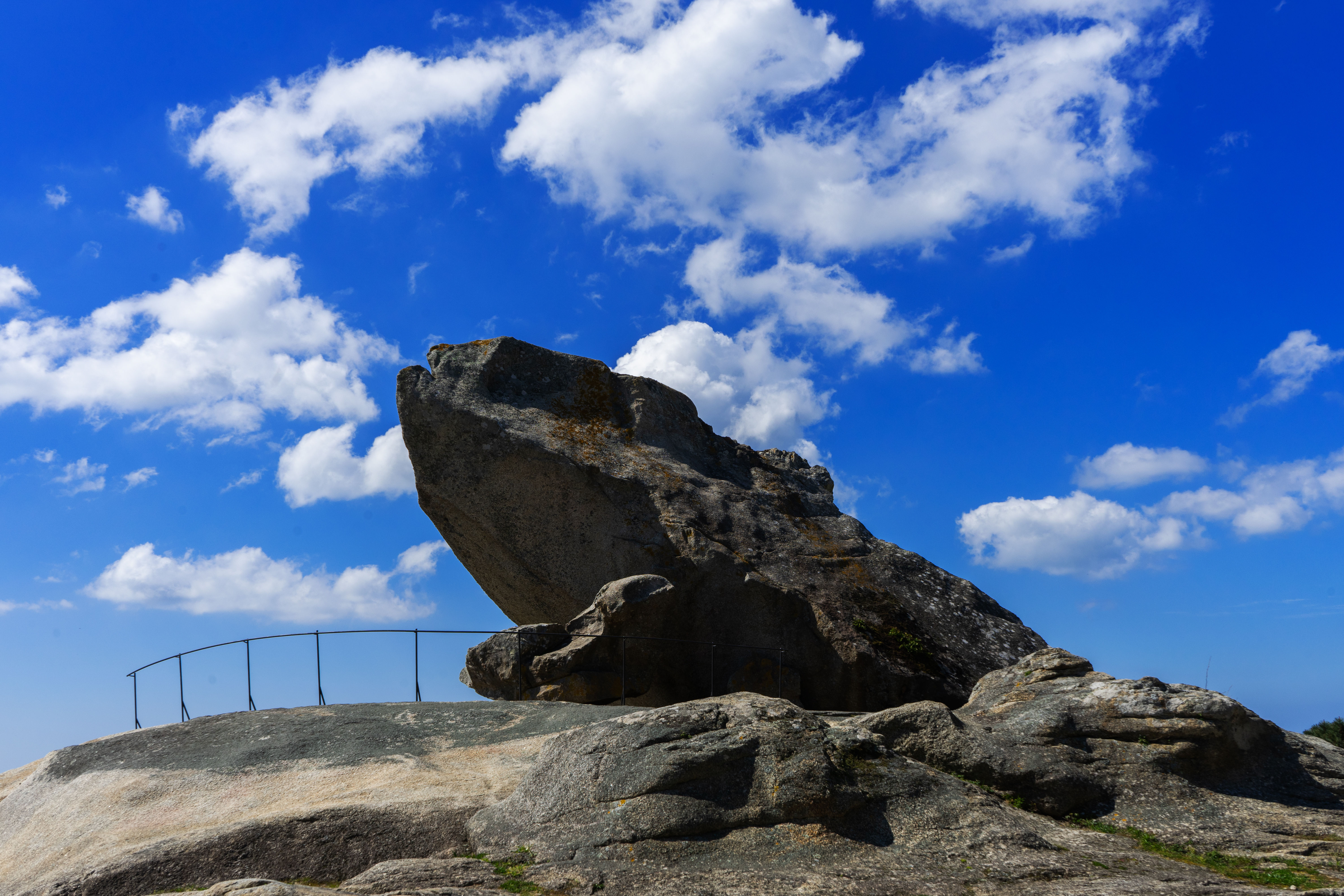
Another interesting viewpoint is A Pedra da Ra, from where you can glimpse the mouth of the bay and the entire Corrubedo Natural Park, including the Grand Dune, Carregal and Vixán lagoons, and the popular O Vilar beach.
Here, the connection to Saint James emerges once more. Besides viewing the mouth of the bay where the Apostle's boat sailed, legend says he leaped across the Corrubedo inlet on horseback from Mount A Cidá (a few meters from the viewpoint) to Corrubedo, leaving his footprints embedded in the rocks. One of them is known today as Saint James's Stone.
Perhaps the most universal legend associated with the natural park links it to the sunken city of Valverde, also known as the "Galician Atlantis." According to lore, the city of Valverde lies submerged beneath Carregal Lagoon. Locals say that on clear days, house beams and bronze mooring rings can still be glimpsed at the bottom of the lagoon.
From here, you will head to O Carreiro in Aguiño. Aguiño is a prime example of a traditional fishing village, as reflected by the fisherman's monument at its harbor.
O Carreiro is a unique walkway that extends into the sea while connecting a group of rocky islets. It sits right where the open ocean's wild waters meet the calm waters of the bay.
Another major highlight of Ribeira is, of course, the Corrubedo Sand Dune. Its scale is impressive, reaching up to 20 meters in height and stretching 1.3 kilometers in length.
Here we reference Atlantis once more, as some legends claim the ancient city of Valverde lies buried beneath this massive dune rather than submerged under Carregal Lagoon.
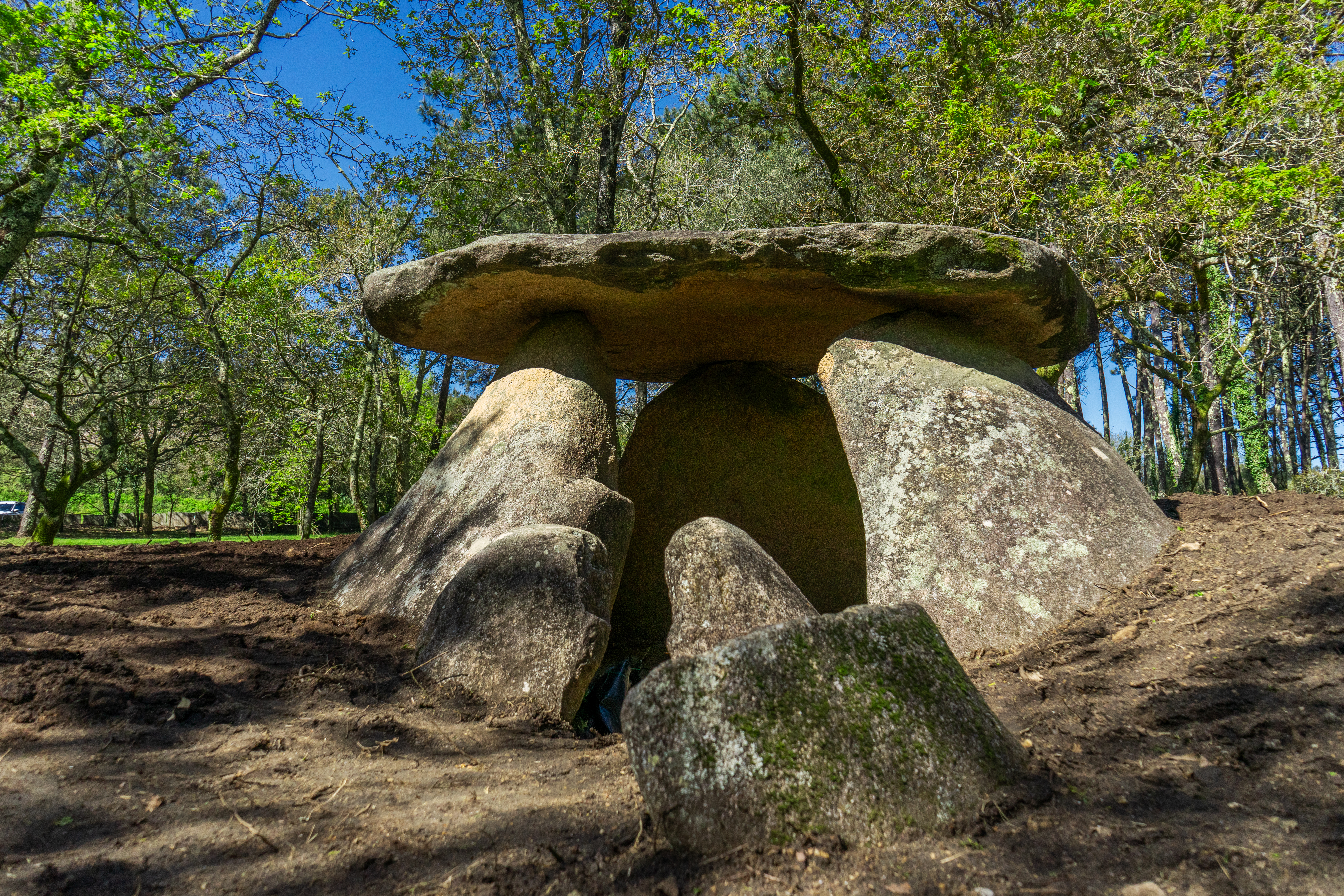
The Axeitos Dolmen is another fascinating landmark you will visit. It is a megalithic monument over 6,000 years old, situated in a quiet woodland in the hamlet of Bretal. Galician mythology is rich with legends surrounding ancient archaeological sites, often featuring mythical underground beings called mouros and mouras who guard hidden treasures. This dolmen is also known locally as A Pedra do Mouro (The Moor's Stone).
Local folklore explains the name of Bretal through a tale of a bishop who, upon passing the Axeitos megalith, looked at it and declared, "Non quero ver tal" ("I do not wish to see such a thing"). Such ancient monuments were viewed by early Christianity as pagan sites, leading to folk stories reflecting this religious pushback.
The next stop will be the coastal village of Corrubedo. Strolling through its narrow streets, you will discover a charming fishing town deeply connected to the sea, accompanied by the whistle of the wind and the sound of crashing waves.
You will spot the traditional dorna boat among other vessels, deeply rooted in the maritime culture of Ribeira.
It was introduced to the Rías Baixas likely as a scaled-down adaptation of the Viking drakkar during the frequent Viking raids attempting to besiege Santiago de Compostela in the Early Middle Ages.
Evidence suggests that prior to the 12th century, Galician sailors adapted Nordic boatbuilding technology, creating a vessel unmatched in functionality, ease of construction, and material efficiency, reaching modern times with minimal changes.
One of Ribeira's most famous festivities is the festival honoring the Dorna every July 24th. It celebrates the community's bond with its flagship vessel and originated as a charitable initiative to raise funds for poorer families through fishing.
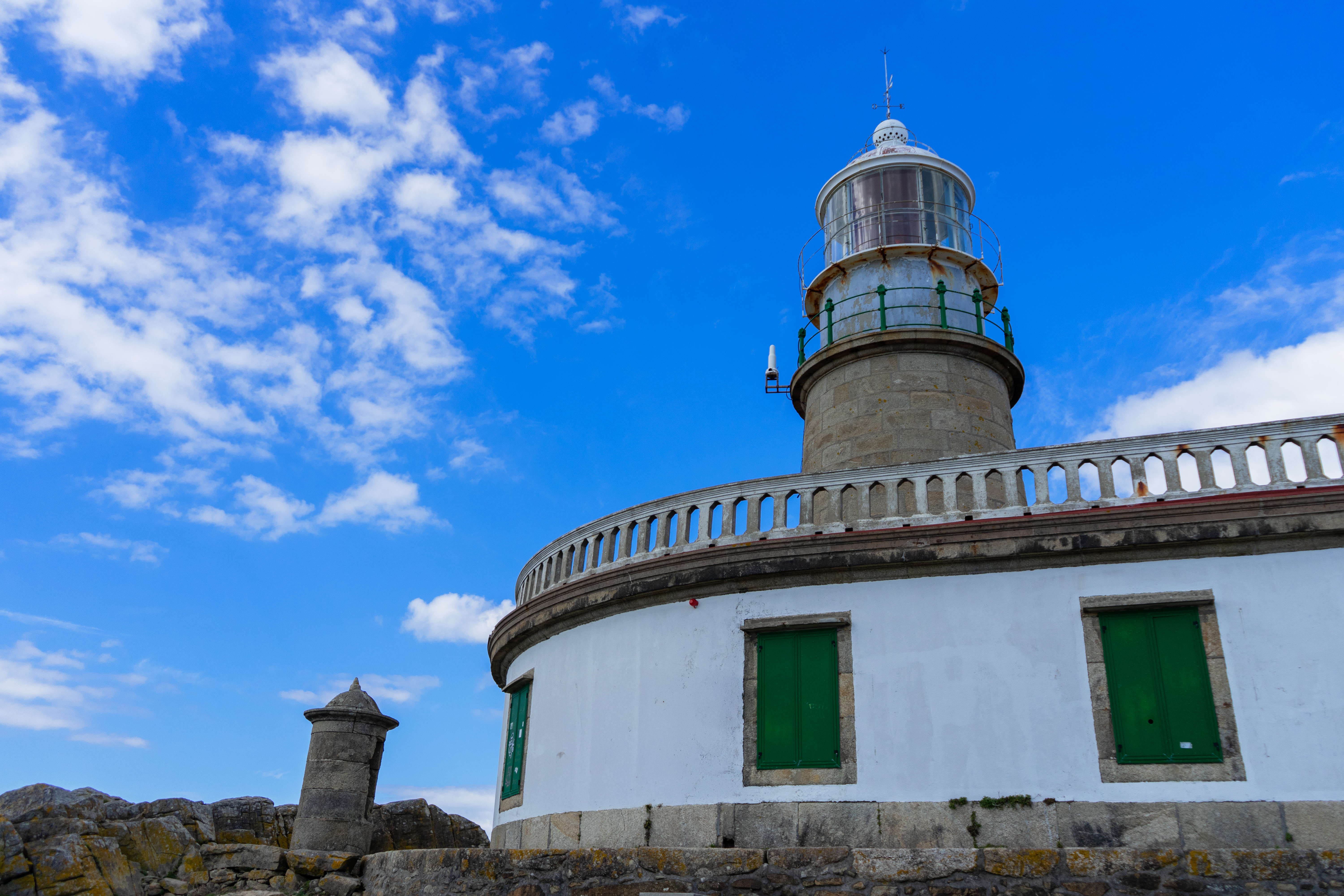
To cap off the day, head to the Corrubedo Lighthouse to witness an unforgettable sunset.
When navigation evolved beyond cabotage, the need arose to build lighted beacons along the coasts, giving birth to lighthouses. The word "lighthouse" in Romance languages (faro) stems from Pharos, an island off Alexandria where one of the Seven Wonders of the Ancient World was built in 279 BC.
The ninth lighthouse along the Galician coast was built in Corrubedo in 1853. Its location highlights why it was essential on this treacherous Atlantic coast. Miscoordination with other lighthouses like Fisterra, Cíes, or Sálvora sometimes caused confusion, as in the case of the Santa Isabel shipwreck. Following this event, the lighthouse's white light was changed to red, earning it the nickname "the communist lighthouse."
Local tradition says that in Corrubedo, an extra hour of daylight remains after the sun sets, giving you plenty of time to enjoy this wild and mesmerizing panorama.
Day 2: A Pobra do Caramiñal - Serra do Barbanza
On this day, you will explore A Pobra do Caramiñal in greater depth alongside one of neighboring Boiro's most sensational spots: the high peaks of the Serra do Barbanza.
A Pobra do Caramiñal is a coastal town deeply tied to the sea, as seen in its harbors: Europe's primary tuna unloading port and the mussel boat fleet docks. Consequently, canning (mussels and tuna) is one of the region's main industries.
This canning heritage is evident in O Arenal's "Catalan Quarter," named after the Catalan merchants who settled here in the late 18th century and spurred the industry's expansion in the 19th century. Their legacy survives today in local Catalan surnames.
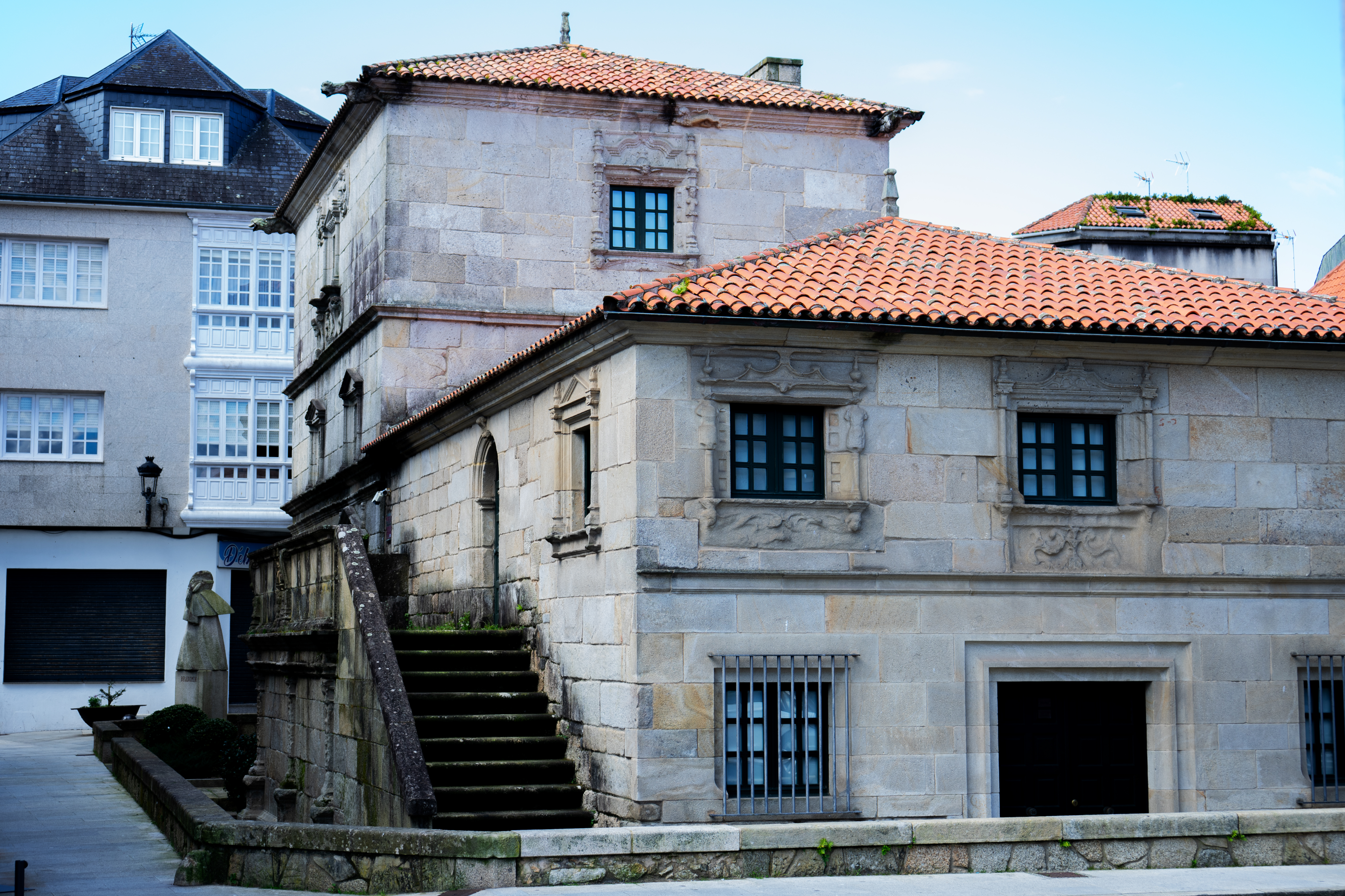
A Pobra is also known for noble manor architecture, represented by grand manor houses (pazos). A prime example is Torre Bermúdez (16th century), former residence of writer Ramón María del Valle-Inclán's family and home to the Valle-Inclán Museum since 1981.
Its ornate facade features carvings of a mermaid and a triton, reflecting the town's link to the sea and the legend of the Mariño family.
In O Castelo Park, you will find the Pilgrim Virgin Wayside Cross, part of the Maritime-Fluvial Stations of the Cross commemorating the transfer of Saint James's remains. Prior to the 19th century, the town was split into O Caramiñal and A Pobra do Deán; the cross shaft displays the caramiña plant and the scallop shell, representing the two communities before their unification.
Another maritime site in the park is the Casa Mariñeira, one of the town's few remaining traditional fishermen's cottages.
Nearby stands Santiago do Deán Church, featuring an image of Saint James on its facade.
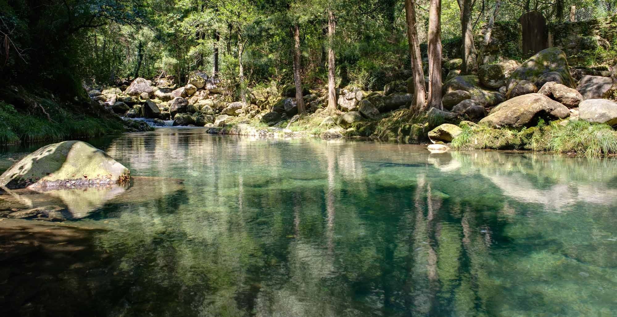
Next, visit the rock pools of the Pedras River, surrounded by lush forest and smooth river stones.
Legend says Saint Maurus navigated the river in a stone boat (identified with a boulder beside the pools) while fleeing persecutors, and divine intervention filled the riverbed with rocks to block their pursuit.
Enjoy a peaceful walk along the Cabío-O Xobre coastal path, skirting Cabío Beach with its white sand and turquoise waters. The historic site of O Xobre includes a church with panoramic views, a rectory, the San Antonio convent ruins, and an Iron Age hillfort at Punta Ostreira. Cabío's promenade was one of the first built in the region, and its beach was the first to receive a Blue Flag.
Transitioning from coast to mountain, drive up Mount Iroite (nearly 700 m high) in Boiro. Besides sweeping views over Arousa and Muros-Noia bays, you can explore the Mámoas burial mound route, featuring over 30 prehistoric tumuli dating back 6,000 BC, including the Arca do Barbanza (Galicia's largest dolmen) and A Casota do Páramo.
Day 3: Boiro - Rianxo
Your final day begins in Boiro at the coastal village of Cabo de Cruz and the Neixón Hillforts, before heading to Rianxo to explore its historic spots and conclude the day along the waterfront promenade.
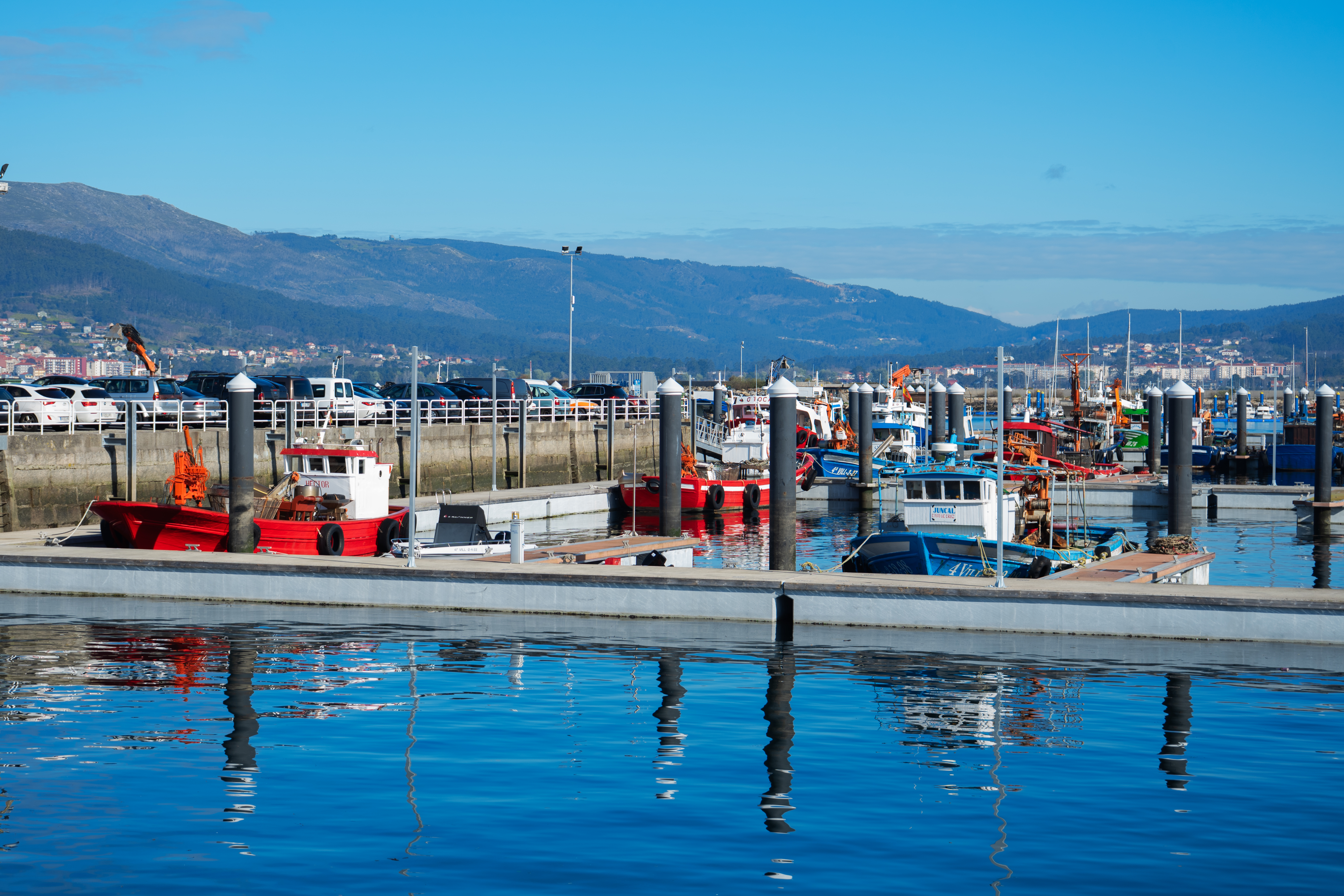
Start in Boiro at Cabo de Cruz, a town with deep maritime roots. Walk along its old pier (among the oldest in the bay), narrow streets, and coastal promenades (Ribeira Grande and Carragueiros) beside white sand beaches.
Its colorful waterfront houses stand out; local fishermen traditionally painted their homes using leftover paint from their boats.
Place names offer history: Cabo de Cruz belongs to Castro parish, named after O Achadizo Iron Age hillfort near the harbor.
The Neixón Hillforts (Castro Pequeno and Castro Grande) are among Galicia's oldest Iron Age sites.
The peaceful landscape invites you to imagine prehistoric life in this setting.
This site is also linked to mythical mouros, said to guard hidden treasures and to have dug an underwater tunnel connecting Castro Grande de Neixón to Rianxo inlet.
Next, move from the coast to A Muralla Viewpoint for views across Arousa and Muros-Noia bays, inland toward Padrón, and even Santiago Cathedral's spires on clear days.
Local theories suggest settlements along Mount Muralla were founded by medieval Frankish pilgrims exiled due to illness or execution sentences, who settled on these steep slopes despite the harsh climate.
In Rianxo, visit Isorna parish along the Ulla River—the river forming the Ría de Arousa and dividing A Coruña and Pontevedra provinces. Sunken Phoenician amphorae and swords evidence its ancient history.
At Punta do Cabo, enjoy views of the Ulla River estuary, Mount Palleiro, and Mount das Cercas.
Here stands a wayside cross belonging to the world's only maritime-fluvial Stations of the Cross (comprising 17 crosses along the bay and river) marking the route of the Traslatio.
The Ulla River brought trade and wealth, but also invasions. River fortresses like Torres de Oeste were built for defense, and historical records mention defensive river chains raised at Isorna to block enemy ships targeting Santiago de Compostela.
Place names reveal history: Mount Palleiro (from palla, straw) was named after the straw beacon fires lit atop its summit to warn of Viking raids.
Mount das Cercas contains ruins of O Castro das Cercas, which served as a commercial port during Roman rule.
Legend says the mouros built internal mountain stairways here to fetch water from the Ulla River safely.
Continue to central Rianxo, walking past the homes of famed Galician literary figures Manuel Antonio, Rafael Dieste, and Castelao along the same street. At A Praciña, see the traditional "oar houses" (casas do remo), built to the width of an oar to maximize waterfront access.
Conclude your day with a stroll along the promenade to A Torre beach at dusk. Across the inlet, you can spot the Neixón peninsula.
Here stand the 13th-century ruins of O Castelo da Lúa, former seat of Paio Gómez Chariño.
The castle's name stems from a romantic legend: two lovers imprisoned in the castle fled by boat at night, were struck by archers' arrows, and washed ashore embraced together before being buried at the castle tower's base.
Having explored Barbanza-Arousa, you will find no better conclusion to your journey than looking out over the Serra do Barbanza and the Ría de Arousa—the two defining symbols of this fascinating land.